Mount Saint Helens–Monitor Ridge

“Want to climb Mt. St. Helens tomorrow?” Impromptu hikes are always fun, but this was a mountain. On a day’s notice. “Why not?”

My cousin Kris, his friend Mike, and I met at 5:00am PST on April 2nd. It was dark, we were still an hour and a half and 60 out miles out from the trailhead and we were already talking about the summit. We were expecting fantastic weather and as proof, Kris and I were covered in sunblock–a preemptive action against the notorious snow burns that catch hikers off guard each year. Not only does the sun beat down from above, but when hiking in snow, the reflection of sunlight can burn skin from below. Hikers are attacked from all sides on trails like this.

Eventually, we reached the trailhead. At about 2000ft in elevation, the winter parking lot is very low in comparison to Climbers’ Bivouac–the traditional summer and late spring launch pad. Since it was so early in the season, we were the only ones scheduled for the day. How exciting! We had the mountain all to ourselves. Sadly though, the clouds rolled in just as soon as we began the day. Our group came to the conclusion that they were low-fliers and we could easily climb above them in the first few miles. But like the beginning of any great disaster story, there must be a certain amount of misguided hopefulness. Summit fever hits hard and it hits fast.

The snowpack was hard, but by no means unbearable. Kris and I were sporting regular hiking boots as our technical gear. Michael is always prepared and had thought ahead to rent some spiffy snowshoes. These worked great for the flatter areas, but as soon as the grade increased, he was back to boots. For every step up, our boots sunk down two to three inches. Sometimes, the ice got so thin that we would find ourselves up to our hips without warning.

Now, we did clear the clouds about a thousand feet from the rim, but the weather didn’t last long.

DSCN1599

Kris breaking through the cloud cover.

Standing just shy of the cornice, we had about three minutes of clear weather, and then the clouds blew in and enveloped us.

DSCN1638

Me and Gnomy enjoying the view

I did my push-ups, and turned back, spending less than ten minutes on top of the world. It is worth mentioning that Mike slowed down and never summited. Instead, Kris and I had gone ahead without him. But now, in a whiteout that was getting progressively worse, Kris and I worried we wouldn’t be able to find him on our way down. Visibility got down to about 30ft and windchill was so harsh that ice started forming on my legs. (Yes, I wore shorts. I’m a Pacific Northwestern for goodness sake!)

DSCN1642

     Whiteout

My cousin and I combed the mountain searching for Michael and I now understand how climbers get lost or thrown off course in whiteout conditions. I thought I saw Michael at least five times. For sure it was him at least twice before we actually found him. Shapes materialize and your eyes play tricks on you. But we did find him and we all headed back down the mountain. Is there where I am supposed to say “I shouldn’t be alive?”

Stay safe out there, hikers!

Two Chief’s Trail (Table Mountain)

8 miles (out-and-back)

1,340ft elevation gain

Beginning this hike at the Bonneville Hot Springs Resort, we were immediately tempted not to do it. The cold, blustery weather of this December afternoon was already biting. But we turned away from comfort and relaxation to conquer Table Mountain–a snow-covered Table Mountain. It all started off fine, but after some confusion and snow blotting out trail heads, we eventually found our way to a trail leading us to Carpenters Lake (all but completely dried up). From here we have several choices and we followed the incorrect path.

Through snow-covered trees, we made our way up and down small hills, around bends and deeper into the Gifford Pinchot National Forest. Eventually, again, we were given the choice to continue following the path we were on, or to divert to the left or right and follow the Pacific Crest Trail. Unsure of where either path would lead us as our map was not very detailed, we decided to continue on our way.

IMG_9709

Kyle Swan Diving into Knee-High Snow

Slowly but surely, the snow began to deepen and we all assumed we were gaining elevation as the snow gained a layer of ice on top of the soft, powdery stuff beneath. We weren’t. Not like we thought we would. You see rather than taking that left onto the PCT, we actually stuck it out on Two Chief’s Trail, which would not take us to the top of Table Mountain. Rather, after more sneak-peak and tauntingly unrevealing viewpoints, we found ourselves at the base of Sacagawea and Papoose Rocks. This offered a great group photo opportunity and we realized that choosing the trail we did was a wise decision as wispy clouds blocked any chance of a view from atop Table and certainly no view of the mountain proper from down below.

IMG_9684

Standing Beneath Sacagawea and Papoose Rocks


IMG_9758

Looking South Across the Gorge

Hearing water not far from our position, we decided to push on through the snow and ice (now up to our knees) and finish off this trail. We found our way and took more photos at this beautiful and dramatic spot called Greenleaf Falls.

IMG_9844

Greenleaf Falls

Here we turned around, took one last look up at the majestic mountains and hit the trail fast attempting to make it home before dark. We vowed to come back in summer and tackle the true Table Mountain now that we know where to go and what to expect. We will be back and we will have photos!

Keep on hiking!

Eagle Creek Trail

On October the 26th, Sarah and I decided to go on a mid-morning hike to experience the Fall colors before they all faded away into the bleak of Winter. Despite some light showers that would come and go as we walked along the Eagle Creek Trail, the weather was perfect. Water trickled down the side of the hill was walked along, casting fog off of its slopes and throwing it into the valley below where it hung mid-air.

Image

Two miles down the gradually sloping trail is the much renowned and frequently photographed Punchbowl Falls. As is life, the moment we arrived at our destination, the rain became more severe, but it did not stop us from having a fun time.

Image

The creek had swelled in the months since I last hiked, and as a consequence, we were forced to walk out on rocks completely surrounded by the slow-moving waters. The view of Punchbowl still wasn’t the best, but it would do.

After several photos and a chat with some other hikers, we set to work stacking rocks, as is the tradition at Punchbowl. There were probably four or five other stacks around us, as others have the very same tradition. Pictured below is the best I have ever seen! Shout out to the person who made this one!

Image

We then ate lunch and talked to a few more hikers before making the walk back to our car.

In short, rainy Fall hikes are still worth the effort. Nature is absolutely beautiful in any season.

Have a great day and keep hiking!

Hamilton Mountain, Summit

Yes, That’s What We Climbed, Emily.

Some new faces on this hike!

Last December, Hannah, Kyle, Tysen and I attempted to hike Hamilton, but the main road was closed so we were forced to hike the equestrian trail in cold, wet weather. Again, this summer, Hannah and I were on the main trail with her brother Noah and his fourth grade class, but we did not summit. Now, sadly without Hannah, some friends and I finally made it to the top.

The day was hot–much hotter than last December. We hiked into Rodney Falls and the Pool of Winds like the fourth-graders did, but this time we ascended the switchbacks and quickly gained elevation. It’s a great hike; not too steep or strenuous.

There was a good view of Beacon Rock along the trail, but once you hit the cliffs of Hamilton, there’s no comparison on the Washington side of the gorge. Huge, 360 degree views, sheer drop offs, and a great lunch spot!

Beacon Rock in the Distance

Be care, though. Here the path was dusty and the grass was slippery. There really was no good way to descend. We had a few falls… nothing serious though, just a few laughs!

The way back was much cooler, being that the trail descends through the woods. We made it back to the car in great time, and I can’t think of a single complaint! Great hike, awesome views, amazing friends. It’s all good.

Until next time, keep on hiking!

Mount Defiance

One year ago, Chantalle and I came to the top of Larch Mountain in Oregon. At Sherrad Point, the view could not be beat. Soon after summiting, two Germans found their way to the top as well. We started to compare hikes and eventually we asked their favorite. Mount Defiance they said without hesitation. We had never heard of it, but Chantalle and I were determined to make it there one day. Finally, after an entire year, she and I arrived at the base of “the mother of all hikes in Oregon”, “the monster”, and the hike that is debatedly “more difficult than summiting Mount Hood”. Oddly enthusiastic and so incredibly unprepared for what was to come, we got out of the car and started towards the trailhead.

The first mile is relatively flat taking us past Cabin Falls, Hole-in-the-Wall Falls, and Lancaster Falls as we walk a portion of the old Scenic Highway. The walk in the park only lasts a short while, however. Don’t let this section fool you. Suddenly, the path rockets upward, switch-backing mercilessly up 1500 feet to a densely forested ridge line. As you climb, putting one foot in front of the other, the thought of blue sky and a viewpoint becomes your motivation. Eventually, your dreams are realized. An excellent panoramic of Mount Saint Helens, Mount Rainier and Mount Adams soothes your forest-weary eyes. Take a moment here to realize how high you have climbed.

The Panoramic of St. Helens, Rainier and Adams

Continue onward and upward. Just because the switchbacks are over for now doesn’t mean the climb is done. You’re not even halfway there! To quote Chantalle during this trying section, “Ever ounce of sweat is worth it!” Bless her heart, she is such a motivational spirit. So I keep panting away, pain shooting through my back as I lean forward, almost parallel to the 40 degree trail. But you must power through. There is a flat portion coming up! I don’t know exactly how long it was, but the level ground was a God-send. Water, water and more water. Breathe in, breathe out. Stretch and keep going. The switchbacks return! Only this time, Chantalle calls them intense! If Chantalle calls something intense, you know that we mortal humans will be dying. And sure enough, she powered through these tight, rocky, incredibly steep switchbacks with little trouble. For me, they were yet another nail in my coffin. For already exhausted legs, this part was killer.

By the time your next viewpoint comes around, you will be at about 4000ft. Don’t be fooled by the look of the trail, you still have 900 feet of elevation left. Continue along the trail until you come to a fork in the road. If you go left, the trail will take you to Warren Lake, then eventually the parking lot. To the right is your goal; the summit of Mount Defiance.

Boulder Fields on the Scenic Route

0.2 miles after the fork, you will see an unmarked trail to the right, which will look questionable at first, but it is a very unique and scenic trail to the top. That’s the way we went. After crossing several boulder fields and catching glimpses of the elusive Mount Hood, one last corner stands between you and the top.

The Summit View

Finally, after more than six miles and nearly 5000 feet in elevation gain, you stand proudly on the summit of the most merciless hike in all of Oregon. Officially the high point in the gorge, Mount Defiance is yours. Sadly, the peak is also home to a noisy and unsightly radio tower. Try to ignore the ugly interruption and look south instead. The plains and rolling hills of Eastern Oregon open up and Mount Hood dominates the horizon. We chose one of the hottest days of the year and Chantalle and I could both feel the sun beating down on us. Nevertheless, we were so tired and sore that we sat on top for about an hour before beginning our long journey home.

Warren Lake

But that isn’t the end of the story. Climbing up 5000 feet is difficult, but going down is far more frustrating. The first part, climbing down to Warren Lake (the left you didn’t take earlier) is actually quite pleasant. In fact, it was very relaxing. We of course stopped by the pretty lake and stayed for a few moments enjoying the variety of scenery. Shortly after, however, begins the plunge. From here on out, the trail drops a thousand feet a mile. With 620 feet in the last 0.3 miles. The trail isn’t very relaxing anymore and each step must be carefully planned so as to avoid any accidental falls. The dust and dirt quickly gives way and if your shoes don’t have much traction, it’s more of a slide than a trail.

Chantalle and I had to keep pushing each other to make it off of the mountain. It wasn’t enough to torture us on the way up, but you must fight your way home too. With more than a mile left, we ran out of water. (I myself brought more than two liters and Chantalle had even more water and yet we still ran dry!)

The last viewpoint on the trail is a point that overlooks the parking lot and stares Dog mountain right in the face. (Did I tell you that we looked DOWN on Dog Mountain for most of this hike?) From this point to the old highway is by far the most mentally challenging part. I was so broken down and worn out all I wanted was to sit down. The downhill was relentless and without any water, we stomped on through dry grass, boiling heat and dusty trails.

Looking down from the trail, we finally saw the old highway and flat ground. After all we had been through we jogged down the last bit and cried out in exhaustion.

We walked slowly back to the car, still standing, still breathing, still living.

Mount Defiance truly is a monster.

Hunchback Mountain

On Thursday, July 12th, my cousin Kris and I set out to climb Hunchback Mountain–a ridge across the valley from West Zigzag. We decided, as we neared the top, that “Hunchback” was a very fitting name; we were leaning forward the entire way up! From a Ranger station to the Great Pyramid, this hike takes you from noisy Highway 26 to the silence of the Mount Hood Wilderness.

Hunchback Mountain from West Zigzag

We started later in the day so it was already pretty warm as we pulled up at the station around 8:30am. Once in the parking lot, (no fee required!) we searched for the trailhead for about five minutes before asking a ranger who said to “look around”. Very reassured, we eventually found the trailhead and started our watches.

About a quater of a mile in, a giant rootball soars into the sky–the tree ripped all the dirt and roots off of the ground exposing a layer of rock one must navigate over. Obstacle number one.

The path is a steady climb upward, switchbacking as usual. By the end of the first mile and a half you have already climbed to 2700 feet. But it doesn’t stop there! The path now straightens but by no means does it level out. We continued climbing to 3150 feet at about 2.1 miles and the forest finally clears to an excellent viewpoint of the Salmon River Valley. Keeping with the newly founded tradition, we did push-ups on the rocks there and continued along the path as it reentered the forest.

After a third of a mile, we saw a sign for the “Rockpile”. A short detour takes you to a large boulder field with views of Mount Hood from the top. Watch your step though! The boulders have large drop-offs between them and there is no trail. I highly recommend the extra up hill.

After this detour, the trail resembles the high forests of the Benson Plateau. Less foliage and taller trees create an eery mood broken only by the occasional bird call. Here, Kris and I noticed the sourgrass and stopped for a taste. Sourgrass is a plant that looks like a big three-leafed clover and characterized by it’s sour aftertaste. (It tasted better than some sour candies I’ve had! I couldn’t get enough of it!) After grabbing a few handfuls for the road, we continued hiking through the forest.

Eventually, after fighting our way through the underbrush with little trail designation (we actually thought we had lost it a few times) we came across a fork in the road. To double the distance, one could go left and work your way to the old fire lookout at Devils Peak, or to end the journey and eat a nice, relaxing lunch, go right to the Great Pyramid. Now at first, we didn’t see what was so special about the Pyramid viewpoint. But then we began to duck under branches and climb downward, through red ants. The extra effort brought us to the actual Pyramid rock and an expansive view of the valley. Here we ate lunch and enjoyed the sound of the Salmon River below. A very beautiful spot with blooming columbine, bear grass, phantom orchid, and many more.

Unfortunately, because the trail oscillated between elevation gain and loss the whole way out, the way home was also uphill and several spots. By the end we were sweating bullets! It was a cool 85 degrees that day and we were hiking in the thick of it! After 5 hours of hiking, eating and talking, we made it back to the car and back to AC.


West Zigzag Mountain

3:45am. That’s how early my alarm went off this morning to go hike 11 miles in Zigzag, Oregon. Chantalle and Kyle showed up at my doorstep right at 4:30 and we were off! Getting to Zigzag is easy enough, but road along E. Mountain Drive is like no other trailhead I’ve ever been to. It’s a very rough road to say the least. Big pot holes, overgrown trees and massive rocks made us question the directions, but sure enough, after about a half mile, we found the trailhead. Guess what? Switch backs! Right off the bat. This trail doesn’t waste anytime-just over a thousand foot climb in the first mile. But it doesn’t get any easier after that! The sloping trail carries you further up the mountain and over ridges with very minimal viewpoints. Alone the route you might be lucky enough to see Adams and Saint Helens if the day is clear.

Then, in the last two miles, the trees begin to open up and eventually the entire Zigzag River Valley comes into view. Stop at a rock outcropping for photos, but know that they’re more to come!

Chantalle and the Zigzag Valley

Up next is a breathtaking view of Mount Hood. With the naked eye, one can see the ski lifts that go up from Timberline and the craggy top of the majestic mountain. More photos needed.

The Majestic Mount Hood

Lastly, as you come around one more corner to a fantastic display of nature in the form of a cliff face with a phenomenal 200 degree view. The Zigzag River far below–you’re initial starting point–the rocks you climbed over to see the view for the fist time, the rounded summit of West Zigzag to your right, and even a glimpse of Jefferson and the Three Sisters. We sat stayed up there for over an hour taking photos, exploring, joking around and eating lunch–even though it was only nine in the morning! While there, we saw our first hiker of the day–but he was no hiker at all! He was a runner who had just done everything we did in half the time! Chantalle deemed him “hero for the day”.

At the Summit

We regretfully left that beautiful viewpoint to hit the trail and begin the long journey home. After running down the mountain, Kyle and I stopped our watches at exactly 6:24:40. Six hours for 11 miles, 3100 feet, 39 switchbacks, a very lengthy lunch and a gorgeous view. We were back at the car before noon! What a whirlwind of a morning! Absolutely fantastic. Then Shari’s on the way back. Of course!

The Group

Nesmith Point

Originally named for the burley Pioneer James Nesmith who endured a wind storm there, Nesmith Point has been deemed the highest peak along the cliffs that line the Columbia River Gorge according to the U.S. Geological Survey. Now, it is used mainly as a training trail for mountain climbers, especially ones bound for Hood. (I plan on attempting a summit in early July–weather permitting). With 30-some switchbacks, 3800 feet in elevation gain and nearly 10 miles roundtrip, Nesmith Point is quite an endurance builder–both mentally and physically.

We began the hike in the early afternoon. I don’t like to do later-in-the-day hikes, but because of conflicting schedules, this was the only time we could go. I started my watch as soon as Kyle, Tysen and I hit the trail. We were off.

Only the beginning…

The first mile of the trail is very typical of Gorge hikes. Ferns, trees, but there are some very nice wildflowers along the way–tiger lily, columbine, candy and star flower… The sloping trail brings you to 900ft at your first major switchback, and from there you’ll work your way over to the box canyon that dominates the next portion of the hike. In 2.3 miles, you will gain 2,300 feet. We started counting the switchbacks to pass time, but the trail kept us entertained the rest of the way. It’s a very fun trail to hike. Eventually, you’ll come to a viewpoint that looks out through the canyon and you’ll see Hamilton Mountain, Table Mountain and Beacon Rock. With Binoculars, one can even pick out the trail that leads up the western and southern face of the giant monolith. The views make up for the burning sensation in your calves, believe me. It’s all worth it in the end.

Beacon Rock from a viewpoint in the box canyon

Continuing through the canyon, a periodic yell will produce an excellent echo effect that’s sure to entertain. Because the trail is so under-used, it’s likely you won’t disturb anyone. The entire trail is  full of obstacles, fallen trees, boulders, creeks, mud and the like. But as you near the end of the switchbacks and start to pull away from the box canyon, the scenery starts to change. It becomes what Kyle deemed, “prehistoric”. Everything gets bigger all of a sudden. Leaves are bigger, trees are bigger, rocks are bigger and that’s when you know you’ve reached the old-growth forest. Beargrass and wild rhododendron will mark the end of the long climb. An obstructed but well-placed viewpoint east is the very end of the switchbacks.

Next is 1.3 miles of relatively flat trails we deemed, “the straightaway”. This will take you through very deep forests along the top of the plateau where, if you stand still, not a sound can be heard. You can literally feel the silence all around you. Truly a unique experience. I suggest stopping a couple time here just to soak in the beauty of stillness. This was also when we came across a hiker–the first one in three hours! He told us that the top was still a mile and a half away. Tysen, not wanting to hike in the dark, suggested we turn around. But Kyle and I were too determined. We started running through the wilderness, looking for any kind of sign, but to no avail. We were almost defeated, but then…

The end of the long straightaway

At the end of the straightaway is a sharp turn to the right. Yes! We were almost there!

This part of the trail begins to climb again, but it’ll be over soon! After a very short hike, you’ll come across an abandoned road which leads to Moffet Creek and Horsetail Creek if taken to the south. But your goal is north. We ran the last of the road up to a damaged sign that said “Nesmith Point”. There were two stumps to sit upon, but we were all too awe-struck to sit. A perfectly clear view of the Gorge and the Columbia River as it snaked its way west towards the Pacific Ocean. Because we did such a late hike (we reached the top around 5:30pm), we were able to see the sun reflect off of the river and shimmer beautifully. We took lots of photos then decided to explore a little more. This is not the end of your journey, merely a treat for your labors. The real end is a little less dramatic. A little ways past this viewpoint is an old outhouse and just uphill of that is the true Nesmith Point–the highest peak on the cliffs: 3,872ft. Stand on that rock, ponder life and the significance of your climb. Completely surrounded by trees, it is simply a rock in the woods, but it is much more symbolic than that.

The viewpoint

View of the Columbia

Tysen on Nesmith Point

If you’d like, you can continue down the sloping plateau to a clearing in the trees that looks out on Hamilton and a very tiny Beacon Rock. It’s a great bird’s eye view for those seeking a little extra something.

Beacon Rock from the plateau

After food and some more photos, Kyle, Tysen and I headed back into the woods. It took us 3h 30min to reach the top. It only took us 1h 39min to descend. That was it. We climbed to the highest point on the Gorge cliffs. Here’s to a job well done, guys! It was a pleasure hiking with you!

On the way home, we stopped off at Shari’s in Troutdale for a victory burger. Fittingly, the Trail Boss. I highly recommend it.

Until next time, keep hiking!

Hamilton Mountain, Rodney Falls

Hamilton Mountain from the trail

Yesterday, I had the pleasure of being a chaperone on a forth grade field trip to Hamilton Mountain. Kids were supposed to identify the plethora of flowers, trees and birds the trail had to offer. I was amazed by the variety. There were candy and star flowers, lupines, tiger lilies, thimbleberries and lots more. But beware! There were also patches of poison oak and stinging nettle.

Tiger Lily, my favorite of the flowers on this trip.

For such a small hike–only 3 miles in all!–there was an amazing change in atmosphere. From the playground and deep forests, to open hilly meadows and rocky rivers, this hike has lots of entertainment for kids of all ages.

The trail itself was well maintained, though muddy in a few spots. Overall, very kid friendly.

After only one mile, there is a divide in the trail, a possible viewpoint of Hardy Falls. I suggests taking the extra few steps as the waterfalls are a refreshing sight for tree-weary eyes. At the 1.25 mile marker, the real fun begins. Go down to a bridge over Hardy Creek for a up close and personal view of Rodney Falls, or climb up to experience the thrilling feel of the waterfall’s spray in your face as you look into the Pool of Winds. This one of a kind waterfall is well-worth the hike in and of itself. Watch your step as the waterfall has tried to retake the path over the years. This shouldn’t be too much of a problem, though. You might just get a little wet.

Hannah and Noah at the Pool of Winds

Rodney Falls

Here we turned around in order to make it back to the buses for lunchtime. However, you can continue up the trail for another two and a half miles to the summit of Hamilton Mountain. I will return this summer to complete what I’ve begun for sure.

Overall, the kids seemed to really enjoy the hike, especially the bridges and waterfalls. With an easy 600 foot elevation gain and only 3 miles round trip, this is a perfect hike for the family. You’ll be entertained the whole way by flora, fauna and wildlife, not to mention awesome views of Bonneville Dam and rushing waterfalls. Can’t wait to go back!

Ruckel Creek

Last weekend, my good friend Laura and I went on a hike at Ruckel Creek, in the Columbia River Gorge. Neither of us had heard of it before, so we decided to give to it a try. We arrived at 7am and used the Eagle Creek parking lot as our base-camp. The sun was just starting to peak through the trees as we reached the trailhead.

To our surprise, after a quarter of a mile, we came upon a paved road–remains of the old historic highway that used to run through those parts. The trail had us follow this road until we came upon a small waterfall–this was Ruckel Creek. Our journey began here.

Immediately, we were climbing switchbacks like mountain goats. We took lots of breaks to “take photos”. At least, that what we told ourselves. Truth was, even us teenagers were completely out of breath! Laura and I continued up the creek, which was now out of hearing range, until we came upon a clearing in the forest. A rockslide lay before us, but it had been entirely covered by moss and wildflowers! The sun still hadn’t reached this area, so Laura and I took a moment to watch the first rays move across the awe-inspiring scene. We climbed around the area for a few minutes, trying to grasp the immensity of it. Eventually, we decided to keep moving. The day would be a hot one and we wanted to get as much work done before we overheated!

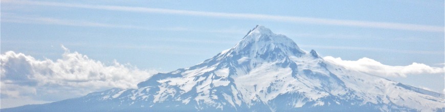
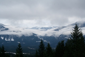
Back into the forest, and back to the climb! After another half of an hour or so, we came upon a ridge that led off the path and to what looked like an awesome view of Bonneville Dam. I crawled through the thicket and came upon a decent view, but had a gut feeling I could do better. Continuing along the ridge, I came to the end of the “path” and decided to go just a little further. I climbed up to the tree-line, and  found a breathtaking view of the Gorge. From this humble ridge, I could see the peaks of St. Helens and Adams, two mountains I hope to summit this summer. (I attempted Adams last year, but that’s another story.)

I took several photos then remembered that Laura was still on the trail. I moved quickly back to her and she promptly told me how long I had been gone. “15 minutes, Sean Philbrook.” I reassured her that I was fine, but that I had seen a group of hikers hightailing it up to us. Laura doesn’t like being challenged, so this gave her the push needed to carry her up the next set of switchbacks.

From there on, not only did the path level out, but the wildflowers really started to bloom too. Indian Paintbrush, Shooting Stars, Larkspur and Phlox. There were so many kinds! I had to stop at each new batch to take note for my grandma. Since she can’t hike to the flowers, I bring the flowers to her!

The day continued and after another rockslide, we came upon a meadow and stopped for lunch. As we sat munching, a group of runners flew past us. We asked what they were training for and they responded, “We’re always training.” Kudos to them! Those switchbacks were killer to hike. Imagine running them! We lay in the sun, soaking up the absolute silence and serenity the meadow had to offer before we started on the trail again.

We caught sight of the other hiking group, and stepped it up again. They were right on our tails!

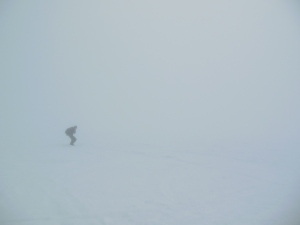
After another couple of miles, and Laura wondering when it would end, we came upon more switchbacks. Here, Laura was ready to turn back, but we were thirsty and totally out of water, so we made the creek our goal. This section was harder than the rest and really pushed us. The runners flew past us, shouting “You’re almost there, keep it up!” They were both inspirational and degrading. I have no idea how those guys could run the trail. Not only was it incredibly steep, it was pretty rough too. There were several spots where the trail was blocked by boulders, trees or completely washed out. Laura started mentioning lightheadedness and dry mouth. I wondered how dehydrated she was and if she could make it much further. Could she even make it back to the car? Putting these thoughts aside, I dug deep and tried running the last bit. Why? Because I’m a stupid teenager. I told Laura to stay on the trail and that I would be back with water in a few minutes. I charged ahead with Ruckel Creek in mind. I could hear the rapid waters, but I couldn’t see them. I kept moving up the switchbacks and eventually came upon an old-growth forest. We were at the top of the Benson Plateau, and I hadn’t even realized it!

“Now Entering the Mark O. Hatfield Wilderness.”

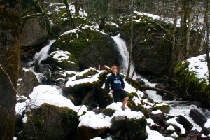
I came upon an old woman with a walking stick in one hand, and a bottle of water in the other. I asked her where to find the river. She said to go off the trail to my right and continue straight until I hit water. “It’s a lovely lunch spot. I just came from there myself.” I thanked her profusely and ran down to the creek. Snow! It was then that I realized how high we had climbed. It was at least 70 degrees and the snow remained by the creek. I questioned the water, then filled up. I drank a bottle or two then ran back to find Laura.

To my surprise, I found the other hiking group. They had not seen her. I panicked. Then, remembering that we said she would stay on the trail, I turned around and went further into the forest. I passed the turn off for the creek and kept going. Eventually, I heard her screaming. “Sean! Sean!” “Laura?” “Sean!” She came running to me, sweaty and panicked and out of breath. “Where were you?!” “Laura, I said I would be back.” “Once the path got flat, I booked it up here to find you.” “You should have stayed there.” “Sean, I thought someone was going to come out from behind a tree and kill me!” (She’s a little dramatic.)

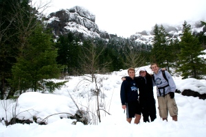
We started back along the trail, after she had had enough water, and came across the group again. They were happy to see we found each other and cautioned us against drinking anymore stream water. We said we wouldn’t have except we were totally out and really dehydrated. They gave us some extra bottles for the way back and wished us a safe trip home.

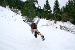
I’m not sure which was worse; the climb up, or the run down. Inspired by those “track stars” and refueled for the trek home, Laura was on a mission to get back to the car in half the time it took us to get up the mountain. We started running and stopped every once in a while to catch a breath or take more photos. On our way back down, and luckily at a time when we were not running, the real runners passed us again. They were going back for seconds! We cheered them on, then booked it for the end. There was no way they could beat us back. Laura was challenged and you know how she gets…

We did get back in record time, but it wasn’t within her goal of cutting the time in half. After nearly 12 miles and a 4,000 foot elevation change each way, my calves, knees and feet were killing me.

Moving at a crawl to get back to the car, we thought about all the great features of that hike we wished were a little more accessible. Even with the horrible switchbacks and length of the hike, we both agreed we would go again this summer.

The whole experience definitely bonded us and I had said at the beginning that we would either like each other even more or hate each other by the end. I am pleased to announce, it was the former. We are still good friends even after hours on the trail and complaint after complaint.

Ruckel Creek is a very deceiving name. Although we did start and end at the river, we barely even heard it in between. Rather than a nice, peaceful stroll along a gurgling creek, this trail led us on a grueling climb up 4,000ft and back. This is certainly a hike to test yourself physically and mentally. Good luck to you all! Pack lots of water!